Waucheesi Mountain – Dual Sport or 4wd
Two Great Dual Sport/Jeep Roads in the Cherokee
National Forest of East Tennessee
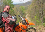
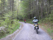
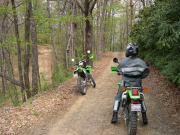
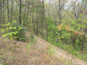
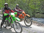
This route is suitable for adventurous intermediate riders on medium dual sports and experienced riders on large dual sports. We rode our KLX250s, but would have had no problem on our KLR650s or even on the unloaded CaporNord. A friend rode one of our KTMs. For the most part the route is easy. In a couple of places there was deep, fresh gravel which can be expected after road work. The road narrowed and became steeper in one section, but did not present any problem for us. The intermediate rating is due to several steep hair pin curves on gravel requiring you to use first gear, rear brake, clutch, and throttle all at the same time.
We began this route in Green Cove which is located on Tellico River Road thirteen miles east of the Cherohala Skyway (TN165). From Tellico Plains follow the signs to Bald River Falls and once on Tellico River Road just keep following the scenic Tellico River until you pass through the small fishing village of Green Cove. Continue another 3/4 mile and take the right turn onto Smith Field Road.
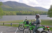
Bald River Road (FR126) is a well maintained Forest Service gravel road that climbs from 2000 feet at Tellico River to a little over 2600 feet before leveling off. We took a right onto Green Cove Lake Road for a short out and back to find the small scenic lake a little more than half a mile distant.
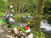
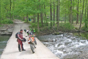
Backtracking to Bald River Road we continued for some three miles along the Bald River before arriving at the remote Forest Service Holly Flats campground. Bald River along this section is really just a creek. It’s hard to imagine how it turns into a beautiful waterfall just a few miles distant. A hiking trail (FT88) follows the river from here to the Falls, about 3 miles.
Kirkland Creek hiking trail (FT85) leads uphill from here. It ends at the Tennessee/North Carolina State Line.
Heading west from the campground on Bald River Road (1850 elevation), the road begins to climb and narrow. It is more winding and not as well maintained. In the next two miles the elevation increases to 2747 feet at Basin Gap.
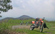
At Basin Gap take the left and ride up to Waucheesi Mountain Lookout Tower. The tower is no more, but the top at 3692 feet bristles with radio antennas and offers some spectacular views of the area. This road is very passable but not one for amateur riders. It is winding, moderately steep and rocky in spots. We met two guys on the top looking for a GeoCache which we never found. The 360 degree view is amazing.
On one Saturday trip in November to this remote mountain top we were having a snack when three pick-up trucks and a Jeep pulled into the clearing. In short order the bald was alive with adults, kids and dogs. Several easy chairs, a generator and television were soon unloaded and the party began watching the University of Tennessee vs. Kentucky football game with a stereo playing Rocky Top Tennessee.
Backtracking downhill to Bald River Road continue west on a long downhill section with a couple of tricky gravel twisties. At the intersection of FR384 take a right on an improved gravel road downhill on Wildcat / Miller Cemetery Road all the way back to Tellico River Road. Take a right on paved Tellico Rivier Road and then a quick left on FR35 (White Oak Flat Road) which takes us up to the Cherohala Skyway. You might want to take a gander at Bald River Falls before heading over to the Cherohala. Just keep going east two miles on Tellico River Road.
INDIAN BOUNDARY
CITICO CREEK
DOUBLE CAMP CREEK
COLD SPRING
From the Cherohala turn into Indian Boundary Road and continue into the Citico Creek Wilderness Area. We entered Indian Boundary Lake to check-out the area and were impressed with the views and camping facilities. Much different than many of the remote camps.
Indian Boundary Lake is a beautiful mountain lake with one of the best Forest Service Campgrounds we have seen. You can reserve sites here and even though there are a lot of sites it might pay to have reservations. Several of the best sites are right on the water.
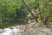
Backtracking north on gravel FR35 there is a much more primitive Forest Service camping area located right on Citico Creek. All of the camping areas were empty, but it was early in the season and a week-day. Peak times for crowds are summer week-ends and especially hunting season. It was enjoyable having everything to ourselves for the entire day.
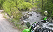
Another mile or so and take a right on Doublecamp Creek Road elevation 1405 feet (FR59). This climbing gravel and rock road is one of the most scenic in the area as it winds 6.3 miles along side of Doublecamp Creek to Farr Gap at 2826 feet. There are numerous small waterfalls and rushing rapids on this route. It is a great place to chill in the heat of the summer. At Farr Gap a connecting ridge road takes you westward to the downhill on Cold Spring Road. From the old site of the Cold Spring Lookout Tower at 3155 feet back down to Citico Creek Road at 1230 feet is 6.7 miles of pure gravel fun.
We were running out of time, so we headed back to the Cherohala Skyway. To continue on an even longer ride you could turn right on Citico Creek Road and follow the creek for another 11 miles to Citico Beach on the Little Tennessee River.
For exploring all of these back roads we highly recommend that you have several other riders with you. It is desolate at times. On our ride we only encountered several other vehicles during the entire day and none at all on the Doublecamp/Cold Spring loop. You should also have maps of the entire area, a cell phone, and GPS would help. All vehicles must be street legal and licensed. We do not recommend these roads in hunting season. It is crowded with hunters and dogs.

