Smoky Mountain Dual Sport
Sometimes my job requires great sacrifice such as this dual sport ride across some of the best back roads in America with three female riders chasing me down. It’s not easy having these gals challenging me at every difficult corner and climb. The pressure was on me to give a good show for all male riders.
We spent several days whipping our KLRs around the mountains on such well known paved roads as the Dragon, North Carolina 28, Foothills Parkway, and Tennessee 73 (Little River Road). And exploring some little known paved gems such as Tennessee 32 (Cosby), NC 1157 (Cullowhee Mountain Road), and NC 1001 (Ellijay/Tilley Creek Road).
Really putting me to the test were the gravel roads. These fems proved to be even better on the forest roads such as Tatham Gap Road (The Gravel Dragon), Tellico Gap, Needmore Road, Mt. Sterling Road in the Great Smoky Mountains, and Winding Stairs.
Nancy and my KLRs have been Wheelerized (tuned by Wheeler). On the pavement we had a little advantage over Jen and Cynthia’s new stock KLRs. Ours are jetted with a pipe, 95% street tires and front fork stabilizers. They can run all over a stock KLR on the Dragon. On the gravel Jen and Cynthia had much better tires with a lot more grip.
Day 1 – Breaking in the Newbie Dualsporters
The weather forecast was marginal. There were spots of rain on the radar and it looked like they would increase in the afternoon. We decided to take a chance and hit the road. No problem if we got the dualsports a little muddy.
We headed out early from the Cherohala Skyway taking the Joyce Kilmer backroad to US 129 and headed for the Dragon. Jen and Cynthia, both sport bike riders, had just purchased their KLRs after riding ours a couple of times and learning how much fun these bikes can be.
Crossing the Dragon this early we had the road to ourselves and the girls threw their bikes into the corners with much glee. We stopped at the Overlook for a couple of picts and then continued north on US 129. We turned north onto the Foothills Parkway relaxing through the many sweeping corners and taking a quick glimpse of the distant views. We then took US 321 into Townsend and gassed-up.
The next stage of the ride is one that Nancy and I have mixed feelings about. Tenneessee 73, also known as Little River Road, is a great cycle road with some of the best scenery you can find in America. The road winds around the western edge of the Great Smoky Mountains for 20 miles and follows Little River much of the way. Rock outcroppings jut out over the roadway and there are many pulloffs to stop and enjoy the river itself. There are also several hiking trails to explore nature and waterfalls. The downside to this road is the traffic. Be prepared to putt-putt for the entire 20 miles as there are few passing opportunities and many sightseers motoring at 25 mph.
Taking a left onto 441 we braced ourselves for one of the most dreaded rides in the area …. Gatlinburg. This once quaint Smoky Mountain town has become a horror show of tourists and traffic. Four lanes cut through the main downtown district and they are packed with cars year round. The sidewalks crawl with pedestrians who sometimes venture into a crosswalk causing mayhem with the vehicular traffic. This place may be attractive to many people but it is not our idea of enjoying the mountains.
Escaping the insanity we lit-up our pipes and headed north on US 321 towards Cosby. At Cosby we took a right on TN 32 which a number of riders consider a good sport bike road. We don’t particularly care for the really tight corners that make the Dragon corners look like sweepers. There are also several concrete bridge railings, many houses with connecting driveways, and local drivers who forget there are two lanes on this highway. We even had two other added challenges ….. a wet and trashy road surface.
Somewhere along TN 32 you enter the Great Smoky Mountains National Park. At the Tennessee/North Carolina State Line (Davenport Gap, 2010 feet) you’ll cross the Appalachian Trail and the road turns to gravel. After a couple of fairly steep downhill switchbacks you’ll come to a crossroads and the old town of Mt. Sterling. Be sure to take a left here and visit Mountain Mama’s, an old school house converted into a store/restaurant. They serve a greasy hamburger cooked in the skillet mountain style. The burger and fries were actually pretty good. If you take a right at the crossroads you’ll find Big Creek Campground with 13 creekside sites that are often full.
All that remains at the remote town of Mt. Sterling other than Mountain Mama’s is the old Hopkins House which was built in 1880 (no longer operational) and the old gas station/store.
The Road from Mt. Sterling all the way to Cove Creek near Maggie Valley is known as the Cataloochee Turnpike. And it is no turnpike believe us. The road was completed in the 1860s and in many places was only wide enough for one wagon at a time. The southern most third of the original route dating to the 1820s stretched from Palmer Chapel on Cataloochee Creek northward to Bald Top, Little Cataloochee and joined today’s route at Dude Branch.
Continuing straight at the crossroads on NCSR 1397 takes you southerly deeper into the Smoky Mountains. The first few miles of the road passes privately owned property and a number of houses. The gravel road is fairly well maintained and a easy ride on a dualsport. One word of warning …. As we did, you might meet a group of horseback riders. Stop and turn off your engines and let the horses pass.
The road climbs steadily passing Ivy Gap (2850 feet) and Double Gap (2980 feet) to the highest point at Mt Sterling Gap (3888 feet). The downhill run to the Cataloochee Creek gaging station and bridge was a hoot. After crossing the Cataloochee the road climbs again 1.6 miles to the intersection of NC 1395 and the Cataloochee Creek Road. Take a left for the fast way out on NC 1395. Take a right to ride along the river several miles to the campground and trailheads. You can then take the paved Ranger Station Road back to NC 1395.
Traveling south on NC 1395 we exited the park. Be aware that this road has fairly heavy traffic for a backwoods road. The road then turns to pavement with some steep downhill switchbacks through residential neighborhoods all the way to Cove Creek and the intersection of US 276.
It was threatening rain, so we decided to head for the barn on US 276, US 74/23, NC 28, and NC 143 back to Robbinsville. We pulled in right at dark and amazingly managed to stay dry all day.
Total Miles: 228
Gravel Miles: 17
Difficulty Level: Moderate on Dragon, TN 32, gravel; Easy otherwise.
Day 2 – Tackling the Harder Gravel Roads
Jen and Cynthia were now ready for graduation. They handled the gravel section on day one with no problem and were now prepared for the bigger and better backroads.
We headed straight for Tatham Gap, a forest road that we call the Gravel Dragon. It’s only 7.6 miles long, but it has some steep and twisty sections that will challenge most dual sport riders. It was chilly as we turned off Business 143 onto Long Creek Road (1110) and headed up to meet the gravel at the Robbinsville Water Plant.
Tatham Gap Road was engineered by the US Army in the 1830s as a route to transport the Cherokee Indians out of the mountains from what is now Graham County, North Carolina. This is actually the first leg of the infamous Trail of Tears to Oklahoma.
The gravel climb begins at about 2400 feet and you hit the first switchback about a mile later. The newbies did great on these steep uphill twisties, coordinating their clutch, throttle and rear brake to negotiate the corners.
After a number of uphill switchbacks we reached the actual Gap and memorial sign at mile 3.4 with an elevation of 3645 feet. From here you can take the dead-end road up to the lookout tower on Teyahalee Bald (also known as Joanna Bald) at 4716 feet. You can’t get in the lookout tower as there are numerous communications equipment kept in the secure building.
From the Gap the road descends for the next 4 miles where it meets the paved road near Andrews at 1915 feet. Nancy and I never tire of riding this historic dual sport road. Jen and Cynthia seemed to like it too and were begging for more. So we headed north on US 74/19 for the Nantahala Gorge and Winding Stairs Roads. This one is hard to find. Go 1.1 mile north from Wayah Road (NC 1310) and watch for the bike crossing zone. There is a small path on the right that is the beginning of Winding Stairs Road. When you first turn onto it you’ll think that you are on a footpath, but it is actually a roadway.
We stopped for a group photo on the bridge over the Nantahala River. It was too early for the rafters and the water was just beginning to run strong. From the bridge the road begins rather tamely, but after about a mile the mountain gets steeper. At two miles the northerly climb suddenly reverses on itself and the road climbs steeply to the south. We think that these slopes have to be the steepest that we have seen anywhere in western North Carolina. They are so steep that it is amazing that trees can grow on them. The Nantahala Gorge and River gets their name from the steep slopes. In Cherokee Nantahala means “land of the noon day sun”. Noon is the only time the gorge gets full sun.
For the next mile you encounter steep rock cliffs on your left and some awesome views off to the right. This is no place to go off the road, so stop if you want to peek. The road levels out and ends at 3 miles (elevation 2968). Here you get a quick glimpse of Queens Falls.
A few paved miles of rural country scenery on Winding Stairs Road, Briartown Church Road, and Otter Creek Road took us to the beginning of Tellico Gap Road and more gravel. Climbing 1.2 miles to Tellico Gap (3868 feet) and the Appalachian Trail is fairly straight forward with a couple of switchbacks. We then had several miles of downhill with a number of difficult steep switchbacks to Tellico.
As you ride into the mountain valley of Tellico (which means plain) you’ll see several old homes and a trout farm. What you might not notice is the giant oak tree on the north side of the road where Cherokee tribes used to meet before the white men pushed them westward. We rode 4.8 miles of gravel on this section.
Jen and Cynthia had taken the worst we could throw at them without the first incident. These girls are some riders!
After Tellico Gap we decided on the easy ride along the Little Tennessee River on Needmore Road. It’s gravel, but level and well packed. We then headed home for the hot tub.
Total Miles 87.0
Gravel Miles: 20.0
Difficulty Level: Tatham Gap Road, Winding Stairs, Tellico Gap Road all present difficult sections, but most of the way is moderate; Neeedmore Road is easy.
Day 3 – Some Great Paved Mountain Backroads
Nancy and I decided to show the girls two of our favorite paved backroads that make a great loop. These are not the best “knee dragging” roads, but present a good challenge on a dualsport at moderate speeds.
From US 23/64 in Franklin take US 64 east 6.0 miles and turn left onto Walnut Creek Road. This road climbs steadily 5.4 miles with some great twisties to Walnut Gap at 4091 feet elevation. The road then levels out for the next 3.6 miles at the left hand turn-off for Cullowhee Mountain Road.
Cullowhee Mountain Road (SR 1157) is 8.6 miles that will test your motorcycle handling skills with some sharp steep switchbacks, tricky twisties, and moderate local traffic. Watch-out for the many driveways, patchy roadway, and gravel spots (mostly in the corners).
Take a left onto Tilley Creek Road (SR 1001) for another test of skills heading back to Franklin. This route begins easy for the first few miles before climbing and twisting to Cullowhee Gap at mile 5.0 and an elevation of 3754 feet. The road then becomes Ellijay Road (still SR1001) as it descends 9.3 miles to US 64. The higher part of this road offers even more technical twisties.
Loop Total Miles: 34.9
Difficulty Level: Moderate
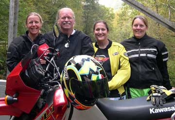
Nancy, Ron, Jenn, and Cynthia
group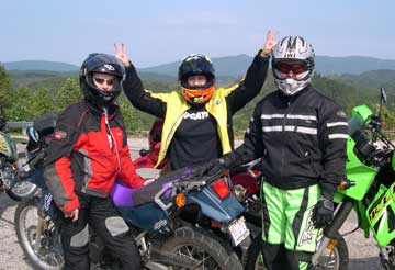
At the Overlook on the Tail of the Dragon
1_overlook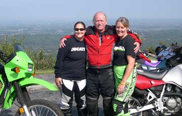
One of the Overlooks on the Foothills Parkway
1_foothillsOverlook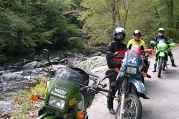
Little River Road
1_littleriver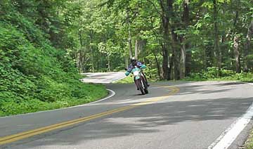
TN 32 between Cosby and the TN/NC State Line
1_32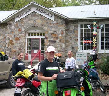
Mountain Mama’s in Mt. Sterling, North Carolina
1_mamas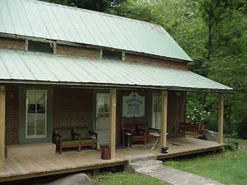
Hopkins House in Mt. Sterling, North Carolina
1_hopkinshouse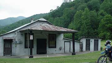
Old gas station in Mt. Sterling, North Carolina
1_gasStation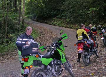
Great Smoky Mountain backroad
1_1397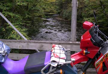
Bridge over Cataloochee River
1_cataloocheeCreek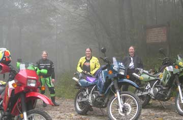
In the mist at Tatham Gap
2_TathamGap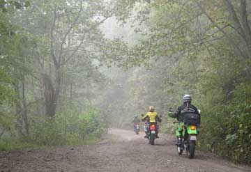
Riding down Tatham Gap Road
2_tathamdown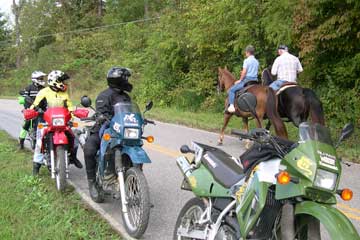
Always stop for horses so you won’t spook them.
2_andrews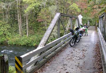
Bridge over the Nantahala River at the beginning of Winding Stairs
2_nantybridge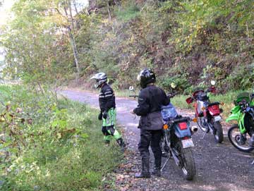
Checking out the steep slope on Winding Stairs
2_winding1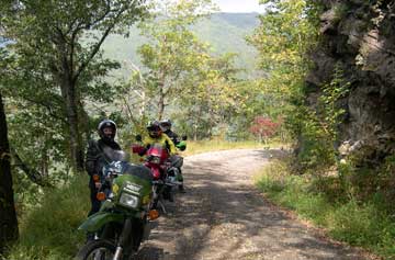
Rock cliff and view on Winding Stairs
2_winding2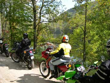
Along the Little Tennessee on Needmore Road
2_needmore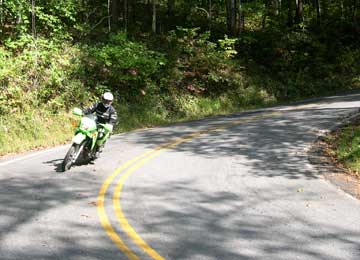
Coming into a great double switchback on Cullowhee Mountain Road
3_cull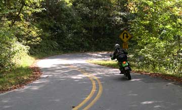
Going into the second switchback
3_cull2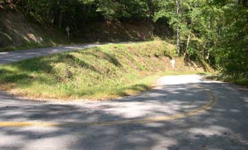
Serious switchback on Ellijay Road
3_ellij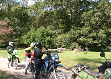
The old Cherokee meeting place in Tellico
2_tellico