The Complete Six Gap 2005
The Complete Six Gap 2005
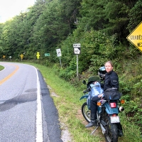
Nancy and I took off for a quick two day tour of the roads in North Georgia on our KLRs. At first we planned to do mostly gravel back roads but then changed our minds and decided to explore some of the paved roads we hadn’t been on in while.
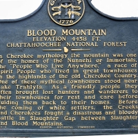
We headed down US 129/19 from Murphy and encountered the usual traffic as we neared Blairsville. Once through town we were able to pass the slower cars and had a wicked ride over Blood Mountain. Be warned, sometimes the law strictly enforces the speed limit on the section of US 129/19, but we planned the trip for a mid-week day with little chance of any special LEO activities.
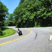
The Blood Mountain crossing is perhaps our favorite road in North Georgia. The mostly three lane highway offers many passing opportunities on the uphill sections in each direction. This makes the hairpins much easier to negotiate on the uphill runs. Watch out on the downhills where single lanes, momentum, and sharp switchbacks can prove tricky. Mountain Crossings at Walasi-Yi offers a friendly stop at the top of Blood Mountain with bathrooms, snacks, a really great outfitting store and is listed on the National Register of Historic Places.
After crossing the mountain we headed south on US 19 into Dahlonega, Georgia. We have stayed at this still quaint college town several times and really like the feel of the downtown area. After checking into the Holiday Inn Express with a room looking out over the Georgia mountains, we cleaned up and headed for Caruso’s Italian Restaurant, home of the Dahlonega Brewing Company. It’s hard to beat a place with great pizza and many beers on tap including their own. On one visit here we enjoyed the live music of Slim Fatz who we were told still plays there on occasion.
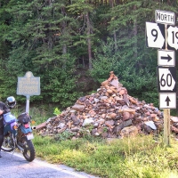
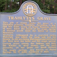
Back to the room we got a good night’s sleep before heading back north on US 19 for Suches. We made a quick stop at Trahlyta’s Grave, a Cherokee princess. Legend says that passerbys who drop a stone on the grave will have good fortune. After hundreds of years there is quite a pile here.
After tossing the good luck stones on the pile we headed northwest on GA 60. The first few miles of this road are quite twisty and lead you to the Appalachian Trail Crossing at Woody Gap (elevation 3183)…. don’t know how it got that name.
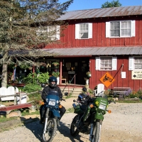
Then it’s downhill past Woody Lake into Suches where Two Wheels Only welcomes only motorcycling visitors. TWO offers food, camping, rooms, and twisty roads in every direction.
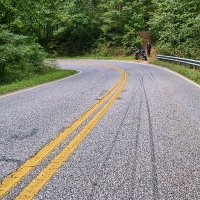
Leaving TWO we continued northwest on GA 60 once again finding a few good twists and turns for about 5 miles around Little Cedar Mountain. One turn in particular seemed to have caught many riders by surprise as the many black marks will attest. Nancy and I always wonder how riders can get in such situations which require locking-up the brakes.
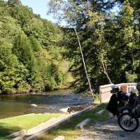
GA 60 then opens up into sweepers along the Toccoa River and through scenic north Georgia farmlands. At Morganton we took Old US 76 west across Blue Ridge Dam on Blue Ridge Lake. A parking area offered an interesting map of the river and dams of the TVA (Tennessee Valley Authority). Continuing west on Old 76 brought us into the back streets of Blue Ridge where we took a left on Aska Road and headed back southeasterly back towards Suches. At Newport Road we took a left and then another left on Old Dial Road. These roads are typical secondary country roads which are decent for scenery and minimal traffic.
We took a quick hop down to check out Sandy Bottoms, one of the Toccoa River Canoe Trail Put-ins. Old Dial Road turns to gravel on the way to this scenic stop which was deserted on our visit. We then backtracked on Old Dial and Dial to GA 60 and then southeast 5 miles where we took Cooper Creek Road north.
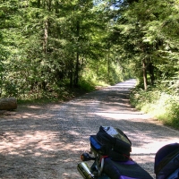
Cooper Creek road is paved for a while as it passes through a residential area and then turns to gravel as you enter the Chattahoochee National Forest. At some point the gravel road becomes Mulky Gap Road passing numerous camp sites. These are well maintained forest service roads easily navigated on our KLRs with our 95% street tires. The right turn onto gravel Duncan Ridge Road was closed as we passed.
We continued northward over Mulky Gap (elevation 2800) and then downhill a few miles where it finally turned to pavement. At the Blue Ridge Highway we took a right and continued into Blairsville. We had been looking for someplace different to eat, but seeing nothing of interest finally decided on the Rib Country in Blairsville. There are two other Rib Country’s in the mountain area (Hayesville and Murphy) and the food has always been good there even as hard as we are to please.
After lunch we headed back south on US 19/129 and took a right onto GA 180 at Vogel State Park. Many riders rave about this Wolfpen Gap road as being another Tail of the Dragon ….. it is not. We find 180 a challenging road, but the pavement is bad, many of the corners are too tight and off camber, there are significant elevation changes, it is difficult to pass slow vehicles, and it is short. After some really tight sections the road changes into rural sweepers with driveways and intersecting back roads all the way to GA 60 at Suches. If you ride here you had better be on alert at all times for dangers.
After a quick u-turn at Suches we headed back north on GA 180 with a pack of sportbikes on our tail. We kept watching our mirrors for signs that they wanted to get around us but they seemed content to follow two wild KLR riders tearing-up the road pretty good. At US 19/129 we took a left and led the group down Blood Mountain at a good clip.
We took a right onto GA 180 and then a quick right on GA 348 also known as the Richard B. Russell Scenic Highway. Russell held seats as a Georgia Representative, Governor, and US Senator. This interesting road begins with long stretches of straight-aways with an occasional sweeper before tightening as it begins to climb to its peak 7.2 miles distant at Hogpen Gap.
Nancy has run the grueling Hogpen Hill Climb here several times. The 10 mile race begins in downtown Helen (elevation 1450) and ends at Hogpen Gap (elevation 3480). The steep climb also hosts a leg of the annual Tour de Georgia professional bicycling event. We stopped for a quick Red Bull at the next scenic pull-off with long-range views looking south into the foothills of north Georgia. Continuing on the downhill side the corners are a little tighter for 6.3 miles to the intersection with GA 75.
Taking a left on 75 we jogged up to GA 17. If you’d like to visit the Town of Helen Georgia take a right. We’ve been there so we took a left and scooted through 5 miles of sweepers on 17 before hitting the real twisties over the Unicoi Gap. Here again the tight corners uphill are aided by three lanes with many passing opportunities. Okay, but not as much fun as Blood Mountain.
GA 17 then flattens out past GA 180 (take a left here to visit Brasstown Bald) and all the way to US 76. Take a left and ride through Hiawassee. We know some of the backroads here, so after passing through town we took GA 17 north, turned left onto GA339 west, then turned right on GA 66 north, and stopped at the state line for gas and a lottery ticket. Then north on NC 1112 into Warne, left on NC 1100 through Brasstown to US 64, then left on 64 and a quick right on NC 141 to Marble and US 19/74/129. We then took US 129 all the way home.
OUR VIEW OF NORTH GEORGIA RIDING
North Georgia to us is dual sport and touring country. You’ll find plenty of fun roads for the sportbikes, but be aware of road conditions. Perhaps we are spoiled with the roads in our area which have smother surfaces, better engineered curves, and fewer driveways and sideroads. You’ll also find the countryside beautiful and clean. Weekends and holidays can bring lots of traffic and enforcement so plan your riding accordingly.
There are still hundreds of miles of gravel dual sport routes in Georgia that we have yet to explore. Being able to transition from twisties, to sweepers, to gravel, and even single tracks makes our KLRs the weapon of choice for us. We’ve had these machines in places that have made us nervous, but they continue to perform well and just keep on rolling.

