Complete Moonshiner28
US 129 to Walhalla, SC
In 2010 and 2015 Nancy and I made complete roadtrip/Run on the Moonshiner 28 from US 129 at the Tail of the Dragon to downtown Walhalla South Carolina. We had almost forgotten how good this road really is.
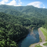
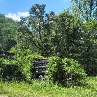
Heading south from US 129 the road has some good twisties along the Little Tennessee River but there are several places to be extremely careful. Just past the dumpsters on the right there is a rather hard left that has caused several serious accidents in the past. There are some small reflectors placed there to warn you of the corner. The first seven miles to the Fontana Dam Bridge has some tight corners and great sweepers. The pavement is good for the most part after some patchwork was done. The patches are smooth and helped a lot.
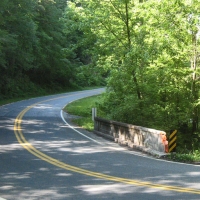
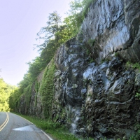
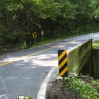
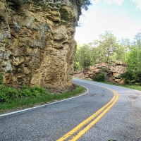
A couple of corners in this section are decreasing radius turns (the corner tightens). In one there is a rock cliff that has claimed at least one life that we recall. At mile 2.7 an intersecting road to Twenty Mile Creek Trail and Falls might catch your attention and divert your concentration from the concrete bridge and a sharp right where a number of accidents have occurred. There is also a boat ramp to the right after crossing the small bridge where traffic may be exiting. SLOW DOWN FOR THE CORNER AND BRIDGE.
10 MPH Corner
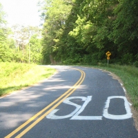
Just a quarter mile farther is 10 Mile an Hour Corner also known as the Widow Maker. This sharp decreasing radius corner is particularly nasty when heading west bound and has claimed a number of lives. A large, bold SLO was painted on the roadway by local riders after a recent death and NCDOT has added ample warning signage. Most of the serious accidents involved an oncoming vehicle, but the metal railing can take its toll too. Rule of thumb ….. see a 10 mph corner sign – believe it.
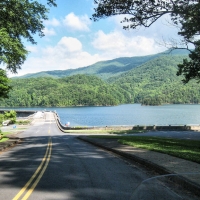
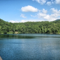
Another mile and a half and the road makes a big left turn following Cheoah Lake. Across the water you can see the Rymer’s Ferry Power Station. The large pipe coming down the mountain carries water from Lake Santeetlah 5 miles distant. This allows power to be made not only at Rymer’s, but also down the river at Cheoah Dam (Fugitive Dam). You can see this overhead pipe on Joyce Kilmer Road, US 129, Yellow Creek and Meadow Branch Road.
The road opens up a little from here to the Fontana Bridge, five miles distant. Before crossing the bridge you can turn into the lower Fontana Dam viewing area road for a great view of the largest dam in the TVA project towering nearly 500 feet above you.
Crossing the bridge you’ll pass the entrance to the Fontana Village Camping Area and come to another corner that should be approached with caution when heading west. It is on a downhill and it is easy to come into it with too much speed and to over correct by over braking. The roadway has hatch marks to let you know a sharp curve is coming. SLOW DOWN
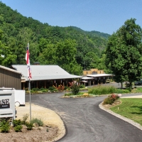
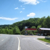
Another mile and you will come to the first entrance to Fontana Village. Originally used as housing for the construction of Fontana Dam, today it is the destination of many tourists looking for great roads in western North Carolina. Accommodations include cabins, motel and a campground. The Pit Stop offers quick sandwiches, souvenirs and fuel.
In the past before the dam construction this area was heavily mined and logged. After the dam was built many small communities, cemeteries and farms were flooded or isolated on the northern shoreline. The property on the north side was annexed into the Great Smoky Mountains National Park and is today only accessible by boat. The Federal Government promised to construct a roadway to allow access to the cemeteries, but it was never constructed. A short segment leading west from Bryson City is today known as the Road to Nowhere. Swain County is looking at a multi-million dollar settlement with the Feds because of their failure to keep their promise for a roadway.
Leaving Fontana Village on Moonshiner 28 you will be in for a thrill as the road quickly descends nearly 300 feet in less than a mile. Watch it on these tight twisties.
At the intersection NC 28 turns off to the right. Stay straight and you’ll pass the Fontana Stables and in 1.3 miles come to the top of Fontana Dam with magnificent views of Fontana Lake and the Great Smoky Mountains National Park. Ride across the dam for the upper viewing parking area and cross back over to the souvenir shop and raised viewing area. Tours down into the dam on the tram are no longer taking place. The Appalachian Trail crosses the dam here as it winds its way from Georgia to Maine.
Back on Moonshiner 28 heading east you get a few glimpses of Fontana Lake before passing Cable Cove. Down this road near the lake is Cable Cove National Forest Camp Ground with 26 primitive sites at $10 a night. This remote area is rarely crowded.
Another few miles on 28 and you’ll see Rainbow Falls on your right. Most of the time the falls are just a trickle. In winter the falls put on a spectacular ice show.
Just up the road is the Tuskeegee Motel. This 1960s style locally owned motel is a clean, reasonably priced place to stay the night. You can grab a hot dog or ice cream and fuel up here too.
From Fontana to Johnson Gap Moonshiner 28 is a fun ride. Nothing too serious in the way of curves, but some good fast sweepers with a 55 mile per hour speed limit.
At Johnson Gap you’ll come to the intersection of NC 143. A right turn here will take you into Robbinsville, the only town of any consequence in Graham County (locals pronounce it GRAY-ham).
After a long downhill run you enter the Stecoah Valley farming community. The Stecoah Valley Center offers a look at the local culture, festivals, musical events, and local crafts.
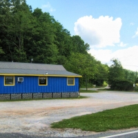
A good place to eat is the brightly colored Stecoah Diner. We’ve had good reports about the food here and their homemade burgers are great. Turn here to get to our favorite motorcycle accommodations, the Ironhorse Motorcycle Resort. John and Charlene have created a scenic, comfortable place for riders on peaceful Stecoah Creek. The western motif takes you back in time. Accommodations include tent camping, bunkhouse, cabin rooms and full house rentals. CLICK HERE
Cresting Edwards Gap the road widens into a four lane. This and other area 4-lanes are favorite places for the North Carolina Highway Patrol to work their radar. Don’t say you haven’t bee warned. It might look like a great place to twist the throttle, but you have a good chance of seeing the judge if you do.
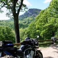
There is a good scenic stop for a view of the Smokies. You’ll also pass the turn-off for Tsali, a Forest Service area with boat ramp, camping, and horse/mountain bike trails. The camping area is usually crowded on week-ends.
Crossing the Nantahala River at Almond you can see the railroad bridge off to the north. This is part of the Great Smoky Mountain Railroad tours from Dillsboro to Andrews. Often there are kayaks in the lake to the south practicing for the whitewater runs.
Moonshiner 28 joins with the four-lane US 74/19 northward for three miles before splitting at Lauada. We recommend fueling at Parton’s BP if you are low. The next gas in 19 miles away in Franklin.
Falling Rock
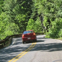
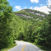
Some of the best twisties on the Moonshiner comes in the next seven miles. But you must ride with caution, especially southbound as the pavement has some ruts, cracked surface and heaves. The worst section is at the cliffs. Northbound is much better. From US 74/19 to the Macon County Line you will encounter a little bit of everything in the way of curves and they will come at you fast. Stay alert and in control. We highly recommend staying near the white line on blind corners, but watch ahead for bad pavement in that line.
At the county line the road somewhat straightens, but you’ll still find some good twists and turns. The closer you get to Franklin the more traffic you will encounter. Clay was discovered in this area in the 1700s and used to make the famous Wedgewood china for the Queen of England. Later gem stones were found in Cowee Creek and you can still stop and search for rubies and saphires in rocks dug directly from the mountain.
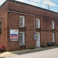
Highway 28 has been rerouted and now bypasses downtown Franklin. But if you take a right at the light on Main Street you’ll pass through the business district. Franklin’s main street offers a number of well maintained small parks, specialty restaurants, shops selling crafts and gemstones, the Franklin Gem and Mineral Museum in the 160 year old jailhouse, and the Macon County Historical Museum.
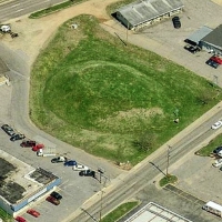
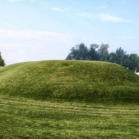
Main Street is one way west, so to get back on 28 you will have to jog over one block to the south and head east on Palmer Street. You will pass a 30-foot tall ancient Indian mound on your left. Once the site of the Cherokee town of Nikwasi, the mound is thought to even predate the Cherokee.
There are a wide range of accommodations in Franklin including locally owned mom and pop motels, national chain motels and various vacation rentals.
Less than a mile hang a right and 28 will eventually join US 64 and you are on your way to Highlands. The first six miles are boring, small industrial sprawl with typical local traffic. Watch out for cars and trucks turning into or out of businesses and side roads. Note the TRUCK ADVISORY signs, always a good indication that the road is going to get good ahead. And it does.
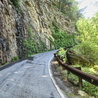
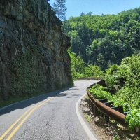
After passing Buck Creek Road on the left hang on. The Moonshiner climbs sharply with Cullasaja Gorge off to the right and vertical rock cliffs to the left. The road narrows with a metal guardrail the only protection from a 250 foot plunge into the gorge. This roadway was cut into solid granite by workers dangling from ropes and drilling 10 feet into the rock to place dynamite charges. The road was graveled and opened in 1931. In those years it must have been one hairy ride. It took several years before Highway 28 was paved. The turns are so narrow that 18-wheelers cannot negotiate the corners today.
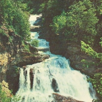
There is a small pull-off on the right where you can stop to view Cullasaja Falls which drops more than 250 feet in a series of cascades. In winter the frozen falls are a real sight. The small parking area is only large enough for two cars but a motorcycle can squeeze in if you are careful. Pavement along here has some heaves and cracks to watch-out for. Once again the north bound lane is in better condition.
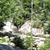
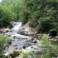
28 follows the Cullasaja River for the next eight miles into Highlands. Stops along this section include a number of pull-offs to view the river and two picnic areas. There is a side road off to the left that leads a mile back into Cliffside Lake. Here you can swim, fish, picnic or take a ¾ mile hike around the entire lake.
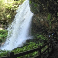
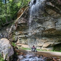
One of the most popular stops is Dry Falls where after a short hike you can walk underneath the 75 foot falls. The parking area was upgraded in 2009.
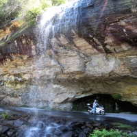
Don’t care to get off the bike? Go another mile and actually ride under Bridal Veil Falls. Moonshiner 28 used to go right under the 120 foot falls, but a bypass was made and today there is a pull-off from the main road. A few years ago a giant boulder the size of a small truck fell onto the parking area. It took several years to remove and determine that no one was under it. For females looking to hook a man, the Cherokee say that maidens passing under the falls will marry before the next snowfall.
Entering the town of Highlands you see Lake Sequoyah off to the right. Highlands, at 4,118 feet elevation, used to be the highest town east of the Mississippi until the incorporation of Beech Mountain, North Carolina in the 1980s.
The area was first explored by Hernado DeSoto in 1540 when he led his party along the approximate path of the Cullasaja from Highlands to Franklin. Failing to find his golden treasure he trudged on to the Mississippi.
The development of Highlands began in the 1870s when two investors took a map of the United States and drew two lines. One connected Chicago to Savannah and the other New Orleans and Baltimore. They crossed at present day Highlands. The speculators began buying property at what they thought would be the giant commercial crossroads of the eastern US.
Highlands did not exactly pan-out to be a trading center, but it has become a destination for many over the years. In the late 1800s the mountain air was touted as a curative for many health problems. Bobby Jones helped to build the Highlands Country Club in the 1930s which attracted many vacationing golfers. Today the population booms in the summer as southerners flock to the mountains for the cooler clime. You’ll see more Florida license plates than North Carolina.
A major event in the history of moonshining took place in Highlands in 1885. A Federal Revenuer arrested two bootleggers from Georgia and brought them to Highlands. Moccasin, Georgia, the home town of the moonshiners became enraged after hearing of the arrest and actually declared war on Highlands.
There was no jail in the town, so the prisoners were being held in the Smith Hotel, today still in business as the Highlands Inn. An army of 18 volunteers from Moccasin arrived in Highlands and set-up headquarters directly across the street from the Highlands House. The Mayor declared martial law and appointed deputies from the local population. Shots rang out for the next three days between the Mayor’s troops and the moonshine army. Finally one of the moonshiners was killed and the rest of the conscripts retreated into Georgia.
The moonshiners, as a result of the incident, promised that no one would be allowed to safely pass on the road from Highlands to Walhalla, today’s Moonshiner 28. This was the only major path at the time and a vital supply line for the town. Supposedly the threat worried some people for a while. One brave soul finally hitched up his team and drove it to Walhalla without incident and the so called blockade was over.
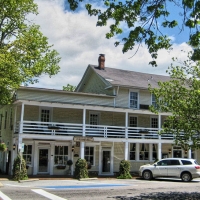
Highlands offers a number of eclectic high-end shops and unique places to eat. The Edwards Inn and Highlands Inn, two hotels in the downtown district, date back to the 1880s and the Moccasin War. The Highlands Inn features a ghost in room 34 if you are into that kind of stuff. Rooms at the inns run from $150 to more than $500 a night. Not too bad when you consider that includes meals and for the higher prices two rounds of golf at a nearby course. The Mountain High Lodge on Main Street has rooms in the $90 a night range with no haunted rooms.
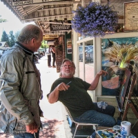
We like to stop at Buck’s Coffee Café on Main Street for an espresso or hammerhead (coffee with a double espresso) to keep our motors running. Good stuff. We also stopped and talked with Rob Saville an artist painting on the sidewalk in front of Ann Jacobs Gallery. He was familiar with the Highwaymen of south Florida, talented blacks who painted swamp and beach scenes and sold them on the side of the road in the 1960s-70s framed for $25. I picked-up one back then and today it is worth more than $1,000. We ended-up buying one of his large marsh paintings that reminded us of the Highwaymen style.
Continental Divide
Heading south out of Highlands the road once again is designated only as NC 28. Traffic begins to lighten as you travel south from here. Soon you cross the Eastern Continental Divide which demarcates the two watersheds of the east coast: the Gulf of Mexico and the Atlantic. The Divide stretches from Pennsylvania to south Florida.
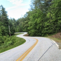
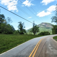
It is not too long before you encounter some more great twisties on what is also known as Walhalla Road. After one turn the giant rock of Satulah Mountain towers into the sky ahead of you. Good pavement and good scenery all the way to the Georgia border 6 miles distant. In those six miles the elevation drops 1500 feet.
Once into Georgia the turns get even tighter but the pavement has many tar snakes – no big deal, but they do bother some riders. Another 6 miles of good riding and you reach the intersection of Warwoman Road. The first three miles of Warwoman are worth an out and back for some good twisties.
Two more miles and you cross the Chattooga River into South Carolina. The Chattooga is designated a Wild and Scenic River and is a popular rafting and kayak destination. The road from the state line into Walhalla is a mix ….. some really tight decreasing radius downhill turns, some good sweepers and some blah coming into town two-lane. Pavement is good with a few rough spots to watch-out for.
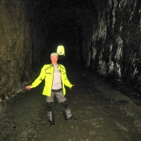
One good stop is the Stumphouse Tunnel and Issaqueena Falls just six miles before reaching Walhalla. The tunnel is a relic from the mid-1800s. The project began in 1852 as an attempt to connect Knoxville and Charleston by railroad, the Civil War and financial difficulties caused abandonment of the project. More than 4,000 feet of the tunnel was completed before work stopped. Temperature in the tunnel is a consistent 50 degrees year round and humidity is so high the walls are always dripping wet.
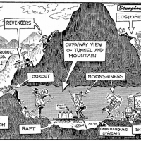
Several other tunnels were completed in the area. Thought to have been abandoned for a hundred years, a discovery in 1963 found one of them was being used by moonshiners. The set-up was quite intricate with a small entrance partially covered with rock to keep away the nosey, a stream midway in the tunnel that required a boat to cross, and the still at the far end with just a small opening to allow the smoke from “cooking” to escape. A cartoon SEE BELOW accompanied the 1963 news article.
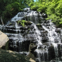
In the same park is Issaqueena Falls, a 200 foot cascade that is easily accessible; at least the top and middle observation deck are. The hike to the bottom of the falls is rather steep and rocky – not the best place to be with riding boots. The view is worth it if you have some comfortable shoes and a little energy. Indian legend holds that an Indian maiden named Issaqueena had married a white man and warned him of an impending Indian attack. The Indians were pursuing Issaqueena to seek revenge. She escaped by hiding on a shelf underneath the falls. Her pursuers thought she had fallen to her death and gave-up the chase.
Stumphouse Tunnel and Issaqueena Falls were nearly sold to a developer in 2007. Enough funds were raised by donations and grants to keep the property in public hands. Today those 511 acres and an adjoining 440 acres are protected from development.
The town of Walhalla appears to be going through tough times. Many commercial buildings are deserted and the downtown needs some enlivening.
So that is the complete Moonshiner 28 from the Tail of the Dragon to Walhalla, South Carolina. There were several times during this trip that we envisioned the hopped-up cars of the moonshiners sliding into a corner with Revenuers in hot pursuit. Or gunshots heard on Main Street in Highlands as the moonshiners demanded the release of one of their own.

