Cades Cove Parsons Branch
Cades Cove Loop is closed to motor vehicles on Wednesday and Saturday mornings until 10:00 a.m. from early May until late September each year to allow bicyclists and pedestrians to enjoy the cove. Otherwise the road is open daily from sunrise until sunset. Parsons Branch Road is closed from November – February, for exact open dates see links below.
For additional information about Cades Cove call 865-436-1230.
Smokies Road Info (SmokiesRoadsNPS) on Twitter
NPS.gov Road Closures
NPS.gove Cades Cove
Nancy and I rode over to Cades Cove a few days after the Parson Branch Road reopened in September of 2007. It had been closed for more than three years after heavy rains caused extensive damage to most of the nineteen water fords along the eight mile forest road. We were pleasantly surprised by the excellent condition we found the road in.
We don’t particularly like going into Cades Cove from May through October because traffic moving at 5 mph or even stopped can be maddening. We arrived at the entrance late in the afternoon and almost immediately got behind a group of 5 mph gawkers. One older couple was even riding on the tailgate of their friends pick-up truck. We managed to get around some of the slower traffic when they stopped at pull-offs.
We can take the slower speeds, but then we came upon a car stopped in the middle of the road to watch a nearby deer grazing. One would think they could have pulled-up another twenty feet into the wide area to let others pass, but they just sat there holding everyone at a standstill. We finally pulled around a few cars and passed them on the two feet of roadway the inconsiderates were not occupying. It still amazes us at the lack of consideration some people have.
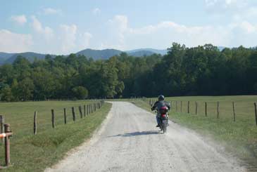
Cades Cove is a free, one-way, eleven mile loop through an idyllic mountain valley. The only access to it is off of TN73 between US321 and US441 in the Great Smoky Mountain National Park . The Cades Cove access road has some good sweeping twisties, but because of the traffic it is not a good place for any speed. You can manage 45 mph when tourists aren’t slowing you down.
In the Cove the scenery is impressive and we even like to stop here and there to take a few photos. It is a great place to come for a picnic and spend most of the day stopping at various exhibits of pioneer homesteads and churches. But if you are looking for a through route to the Dragon take another route. Do not let MapQuest or a GPS unit lead you into this sightseers morass. There are two two-way cut-thrus allowing for either a return to some of the loop or a faster exit. Many frustrated motorcyclists have opted for the “quick escape” as their HDs overheated.
The single lane pavement is okay, but somewhat rutted in places. At 5-10 mph this is no big deal. This is no place for speed because of the traffic. (UPDATE: CADES COVE REPAVED IN 2010)
There are two exits other than returning to the entrance and TN73. One is the one-way, nine-mile, winding gravel road over Rich Mountain which takes you out near Townsend. The other is Parson Branch Road , an eight-mile gravel road with some twists and nineteen water fords. This trip found the fords with extremely low water, but after heavy rains the fords might be a challenge for some riders. The road is in excellent condition and hard packed. The last time we rode it a few years ago we found lots of thick, loose gravel. It is much better today.
Parson Branch brings you out onto US129 at mile marker four on the Dragon. We do not recommend this route for the average cruiser rider or sports cars. Experienced riders could make it on any type of bike and even family cars would have no problem. Remember it is one-way and once you are on it there is no turning back. The Park Service frowns heavily on anyone who does not heed their rules so be forewarned. You can even get a $50 ticket for leaving food on a picnic table while you visit the nearby restroom. And you thought the Tennessee Highway Patrol was bad.
On the map you can see the access from TN73 into Cades Coves at the upper right. The oblong circle is Cades Cove and the two purple lines are the two-way crossovers. Rich Mountain Road leads off to the north about one-third of the way around the loop. Parson Branch leads off at about half way.
Parson Branch Road is closed in the winter, November 16 to May 15. It is also closed at dark during the other months. Backcountry camping is allowed by permit only. On Parson Branch Road the elevation begins at 1929 feet, climbs to 2786 at mile 3.3 crossing Hannah Mountain, and then descends to 1360 at US129. Maximum grade is 13%.
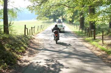
Entering the one-lane, one-way, Cades Cove Loop.
traffic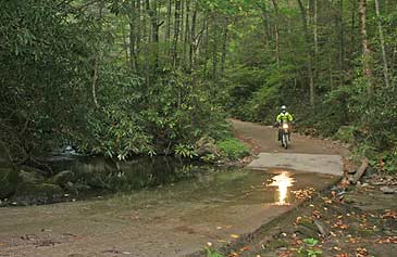
Parson Branch
Ford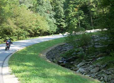
The Cades Cove access road from TN73.
CadesCoveAccess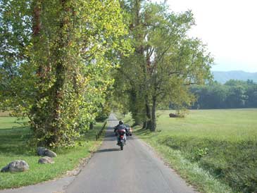
Cades Cove
CadesCove5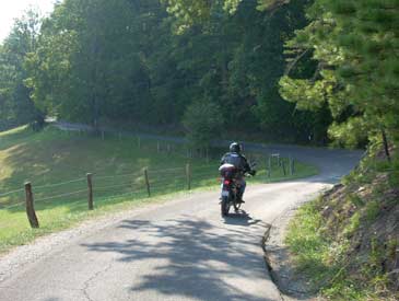
Cades Cove
CadesCove4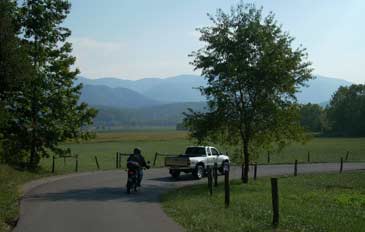
Cades Cove
CadesCove3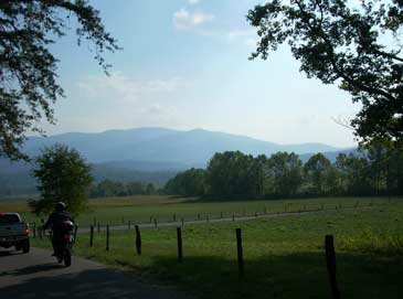
Cades Cove
CadesCove2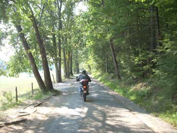
Cades Cove
CadesCove1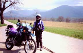
Cades Cove
cadescove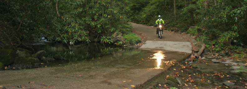
Just one of the nineteen water fords on Parson Branch. These crossing are mainly in the last three miles.
Ford_wide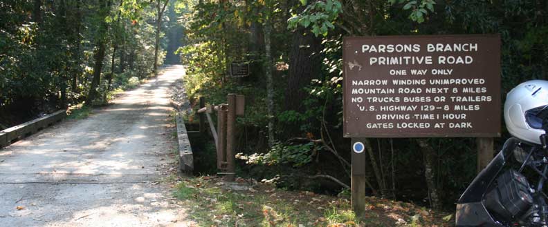
The actual Parson Branch Road begins about 2 miles from the Cades Cove Loop. Turn right and cross the branch
Road_wide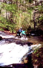
Parson Branch
parsons2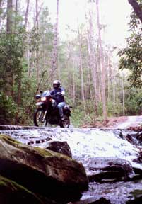
Parson Branch
parsons1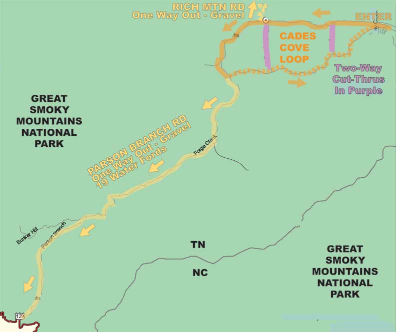
ParsonMap
The Parson Branch access road turns to gravel.
ParsonAccess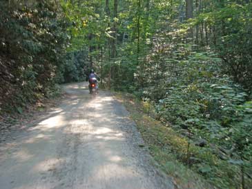
The road conditions are consistently good for a gravel road.
Parson2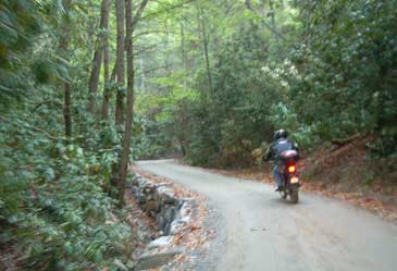
Parson Branch begins in heavy forest.
Parson1