Back of the Dragon & Claw of the Dragon 2014
Tazewell to Marion, Virginia
In September of 2014 Nancy and I headed north into Virginia to explore the Back of the Dragon. A number of people have been asking about it and the trip was a good excuse to take a couple of days off.
After several days of web browsing Nancy finally found a unique place to stay near Pounding Mill, Virginia. There were not many vacation rentals in the area and we hate to stay in boring motels. Cuzs Uptown Barbeque and Cabins looked like the unusual kind of place we like. Located just 8 miles from the northern terminus of the Back of the Dragon, it offered seclusion and comfort, two of our lodging requirements.
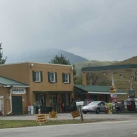
Cuzs BBQ is on Rt 19/460 just a few miles east of the small Virginia community known as Pounding Mill. The restaurant and cabins are normally closed on Monday and Tuesday nights which were the two nights we would need. The owners were happy to let us stay those two nights.
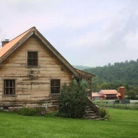
The two small cabins sit high above the restaurant and roadway sandwiched between two ridges populated with grazing cows. There is a large swimming pool which was way too cold for us. We did make use of a small fire pit where we cooked dinner on both nights. We have the place to ourselves the entire stay.
Tuesday morning we headed for Tazewell. The GPS only located one local eatery on main street, but it was closed. We had to settle for a fast food biscuit that was terrible. The coffee was decent.
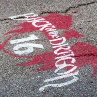
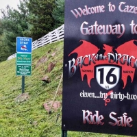
Touring the Tazewell area we were impressed by the many signs touting the Back of the Dragon. Seems like the state and the town embraced there “two lane tourism” much better than North Carolina and Tennessee ebrace the Tail of the Dragon. The town even had Back of the Dragon logos painted every so often on the pavement of Main Street itself. A number of businesses sold Back of the Dragon souvenirs.
THE TERRAIN
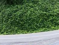
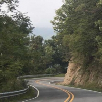
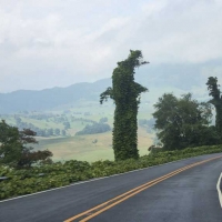
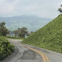
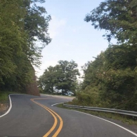
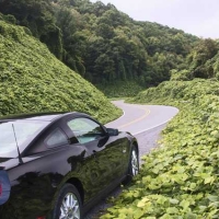
We headed south on VA 16 (also known as B. F. Buchanan Highway) and in 8 miles found the beginning of the twisties. The first climb is impressive with both sides of the pavement thick with kudzu. We have kudzu in North Carolina, but this is as thick as we have ever seen.
The Back of the Dragon is touted as have thirty-two miles of twisties instead of eleven of the Tail. In truth there are twenty miles of twisties with a couple of nearly straight sections in between. The thirty-two comes from counting the entire distance from Tazewell to Marion.
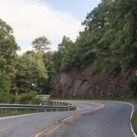
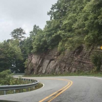
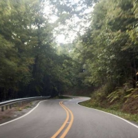
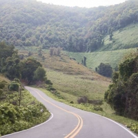
Heading south VA 16 crosses two Clinch Mountain ridges. Thompson Valley lies at about 27-2800 feet elevation. The first ridge is a modest climb to 3260 feet. Then there is a slow descent to the next valley at 2100 feet. There are twisties, guard rails, gravel and deer the entire four miles.
Two miles later the climb and twisties return with even more deer. Two miles into the climb the roadway crosses the second ridge at 3050 feet and then descends once again to 2000 feet. The road then climbs again to the next ridge at 3440 feet, the highest point on the Back of the Dragon. the final descent of 3.5 miles ends at Hungry Mother State Park. It is another 3.5 miles into the town of Marion.
ROAD CONDITIONS
- The mountain sections of the Back of the Dragon have for the most part good pavement.
- There was one short section marked ROUGH ROAD and it was.
- There are numerous corners with gravel in the roadway.
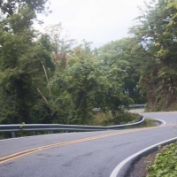
- Just about the entire Back of the Dragon has guardrail and in some places it disappears under a cover of kudzu.
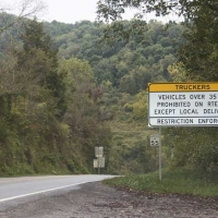
- We did encounter a few logging trucks, but no 18 wheelers which are banned.
- The curves are fairly flat, not banked like on the Tail of the Dragon.
- There are very few pull offs.
- There are a couple of switchback corners that the locals call “kiss your ass” corner.
- We recommend this road to intermediate and experienced riders/drivers. It is not a place for knee dragging with deer, gravel and guardrail present. Take it easy and enjoy the pace on this scenic mountain roadway.
OTHER POINTS OF INTEREST
Burkes Garden – Located east of Tazewell on VA 623. This mountain cove reminded us of Cades Cove in the Great Smoky Mountains, except this cove is occupied by many expansive farms with grazing llamas, horses, goats, mules and cattle. The general store where Nancy freaked-out on our last visit is quaint and now run by an Amish woman. A good photo op is the defunct post office with old gas pumps still in place. The loop road will take you completely around to VA 623 which is the only paved way in and out. The southerly exit to VA 42 is graveled and steep. The Vanderbilt family tried to buy this secluded property in the late 1800s but were turned down. They eventually moved farther south to Asheville North Carolina to build their estate.
Hungry Mother State Park – Located on the Back of the Dragon 3.5 miles north of Marion. Virginia state parks are highly rated for facilities and natural preservation. Here there are camping areas and cabin rentals. There is also a restaurant. Group meeting facilities are also available.
Marion – Located at the southern terminus of the Back of the Dragon. One of the few towns to be designated Virginia Main Street Community and National Main Street Community. Great downtown to explore. We found several good buys at the Past Time Antique Emporium. And then we bought some Virginia Stillwater and Back of the Dragon Moonshine at 112 East Main Street. We even got a tour of the moonshine plant located a few miles from town. Some good local restaurants too. Lots of local artisans.
Other Roads – There are a number of loops that include parts of the Back of the Dragon and other roads in the area. The largest loop is known as The Claw of the Dragon and stretches for 224 miles making it an “all day ride”. Smaller loops include Possum Run (62 miles), Woolly Mammoth (138 miles), Turkey Strut (96 miles) and Horn of the Cow (94 miles). See posted map.
Nancy and I rode many of these loops on our 2007 four-day exploration of the area. SEE HERE

For more information on Back of the Dragon and other roads in southwest Virginia, visit ClawoftheDragon.com
For more details, visit ClawoftheDragon.com

