Moonshiner28 Triple Loop
Moonshiner 28 and Other Great Roads
274 mile Triple Loop
Leave Early and Take the Entire Day !!
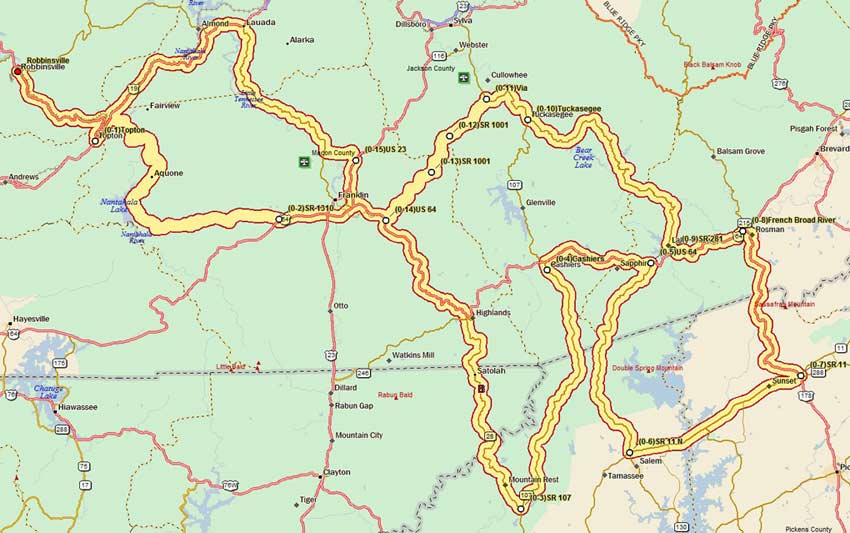
This loop begins and ends in Robbinsville and crosses four state lines in its 278 miles of excitement. Warning …. several stretches are technical and I would only recommend them to experienced riders. All of the route is paved although one section is “unmarked” pavement.
Robbinsville to Franklin
From Robbinsville take US 129 south to Topton (11 miles). This section has some good twisties for the last two miles. Too bad the road was straightened here. If you look into the recessed coves in the winter you can see the original roadbed. Take a left onto US 19/74 at Topton. At 2.3 miles turn right onto SR 1310 (Wayah Road) at the Nantahala River Put-In. Wayah Road (27 miles) climbs along the Nantahala River with many scenic sections of small waterfalls. The road levels off as it circles Nantahala Lake at 3013 feet above sea level, the highest lake east of the Mississippi. Stop and take the Bigfoot Burger Challenge at the Lakes End Diner.
Wayah Road climbs again as you leave the lake and head up to Wayah Gap at 4180 feet. Dual sport riders can take the 4.5 mile gravel road out to Wayah Bald for some great views. From the gap SR 1310 descends steeply for the first several miles before leveling out along Wayah Creek.
Franklin to Highlands
At the stop sign take a right onto SR 1442 and then a quick left onto US 64. Take US 64 east bypassing Franklin. Just east of Franklin US 64 joins Moonshiner 28. Watch for the exit off of the 4-lane.
The road is tame for the next ten miles but then it suddenly climbs into the rocky crags of the Cullasaga Gorge. Cullasaga Falls is a scenic stop, but there are only a few places to pull off on this tight section of mountain road with 400 foot drop-offs. Be careful here, it’s not for the squeamish. the rest of the way into Highlands has some sections of roadway that are heaved and sagging. Lots of road snakes to watch for in wet weather. Traffic can also be a problem here.
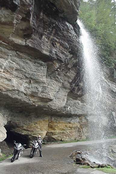
Pull into the Dry Falls parking area ($2 parking fee) and take a short hike to stretch your legs under Dry Falls. A few miles farther and you’ll come to Bridal Veil Falls on your left. You can ride you cycle under this waterfall.
Another mile or two and you’ll enter Highlands. The Highlands Smokehouse on your left is a great place to eat. Highlands is an interesting town to walk around. Lots of trendy shops, an ice cream parlor and a good coffee house. As you pass through Main Street imagine the 1885 three-day shoot out that took place here between the Revenuers and the north Georgia moonshiners.
Highlands to Cashiers via Mountain Rest
SR 28 leaves US 64 at Highlands and turns due south heading for the Georgia Line. Good road surface through some great twisties along this section. A few miles into Georgia you’ll see Warwoman Road on your right. Some good curves here if you want to run out three miles and then backtrack.
Another few miles and you’ll cross into South Carolina and the crossroads town of Mountain Rest. South of there you turn left onto SR 107 and head northward. The pavement here looks funny, but we had no problems at all. The road is rather straight, but as you near the North Carolina border you’ll encounter some twists and turns all the way into Cashiers. We had a couple of bowls of tasty soup (white chili and tomato bisque) at the Cafe 107 in Cashiers.
Cashiers to Rosman via Salem and Sunset
From Cashiers we headed east on US 64 once again. Some real good curves if you can stay away from traffic. Saw sign for Cornhole Tournament ….. must be different than what the term used to mean.
East of Rosman we turned south again on SR 281. Some good pavement and curves all the way into South Carolina. You’ll pass Whitewater Falls on your left. Parking fee of $2 for this spectacular 411 foot tall waterfall. You’ll have to hike to get close, but it’s a short walk for the main view.
Crossing back into South Carolina the road turns into SR 130. The roadway is good with sweeping curves. This is desolate forested country and then all of a sudden we came upon a long line of 18-wheelers parked at a factory entrance. It was the CG Roxane truck entrance where they produce bottled water.
At the Intersection of SR 11 we take a left onto Cherokee Foothills Scenic Highway (SR 11). You’ll soon get a good view of Lake Keowee and the many mountain homes dotting the shore and hillsides. SR 11 has no curves for some 15 miles, so let it out. We didn’t see any LEOs.
Hang a left onto US 178 to get back into some good twisties. Bobs Place, a local biker hangout, is on your left. It doesn’t look like much but advertises “we are a small town bar with deep roots with deep history, we are in the SC book and labeled top 20 places to visit in SC, so come visit the hillbilly nation Bobs place, aka Scatterbrains “where the thunder always rolls”! Their specialty on Facebook is “Drinks”. We didn’t have time to stop.
US 178 has some great curves and little traffic. It passes through Rocky Bottom, the South Carolina version of Old Rocky Top in Tennessee we guess. A few more miles and you’re back in North Carolina. Jog through Rosman and then hang a left onto US 64 for the third time today.
Rosman to Franklin via Cullowhee
Head west 7 miles and take a right onto SR 281. This road used to have 5 or 6 miles of gravel, but it has now been paved. It’s still tricky though with a lot of gravel in the roadway. Take it easy. You’ll cross the dam at Wolf Creek Reservoir as you head north on 281 for 25 miles to Tuckasegee.
Turn right heading north on SR 107 for 5.5 miles. Then turn left onto SR 1001 in Cullowhee. This road can be difficult for inexperienced riders with switchbacks and unmarked pavement, so plan an alternative route if you are not confident of your riding skills.
SR 1001 (Cullowhee Heights, Tilley Creek, and Ellijay Road) twists and turns 15 miles southwestward back to US 64/SR 28 east of Franklin. It crosses Savannah Ridge through Cullowhee Gap at 3800 feet elevation. There are some sharp and steep switchbacks here. Watch for gravel in the roadway too.
At US 64 take a right heading back westward toward Franklin. After 3 miles take a right onto US 23/441 north. Stay in the left lane and take a left after 3.7 miles onto Sanderstown Road. This 3 mile short-cut saves you from going through Franklin.
Franklin to Nantahala
At SR 28 hang a right and have some fun on Moonshiner 28 for the next 16 miles to US 19/74. Watch out for some bad pavement in some sections of SR 28.
Heading south on US 19/74 you have 2 miles of 4-lane before the road narrows and winds through the Nantahala Gorge for some 14 miles. Nantahala is Cherokee for Land of the Noonday Sun. This gorge is so deep and narrow with tall mountains on each side that the sun only hits the ground at noon. This scenic roadway follows the Nantahala River with whitewater rafters enjoying the rapids.
You can order a Tail of the Dragon Burger at the River’s End Restaurant located right on the water in Wesser at the NOC. Watch out, it’s hot.
Nantahala to Robbinsville
After the Gorge take a right back onto US 129 and return to Robbinsville. Grab some BBQ at the roadside stand or have a sit-down meal at Lynn’s Place across from the courthouse.
Summary
This 278-mile route has something for everyone. There are places where I wouldn’t try dragging a knee because of the road surface and loose gravel. There are a few sections where you’ll have to deal with slower traffic. Be aware that it is a full day ride so leave early. We rode this route in early November and were surprised at the great color that was still showing in northern Georgia and South Carolina.
Bridal Veil FallsF
bridalfalls2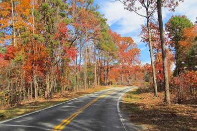
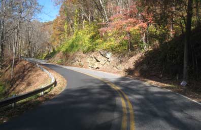
SR107
Moonshiner 28 north of Franklin has some patch work. Also watch out for heaves in the roadway at The Cliffs.
Moonshiner 28 entering South Carolina.
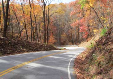
SR28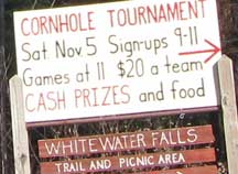
Sm_Cornhole
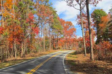
SR 107 can have some great color in the fall.
SCColor
RockyBottom
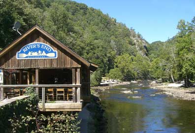
Rivers End
RiversEnd
Moonshiner28
Map
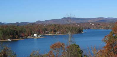
Lake Keowee
LakeKeowee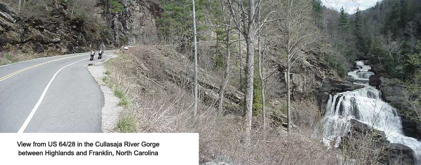
Cullasaga Gorge
cull_gorge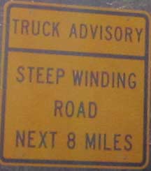
Truck Advisory
TruckAdvisory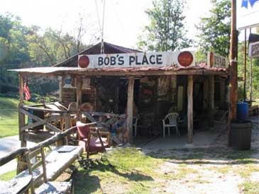
Bobs Place
BobsPlace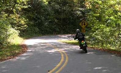
Tricky section on SR 1001 (Ellijay Road).
1001
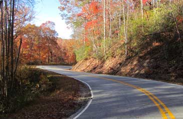
Wayah Road
1c_wayah_corner1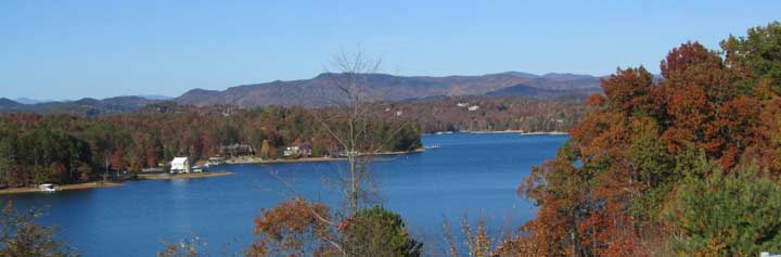
Lake Keowee as seen from SR 11.
Wide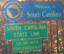
Welcome to SC
WelcomeSC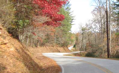
Warwoman Road
Warwoman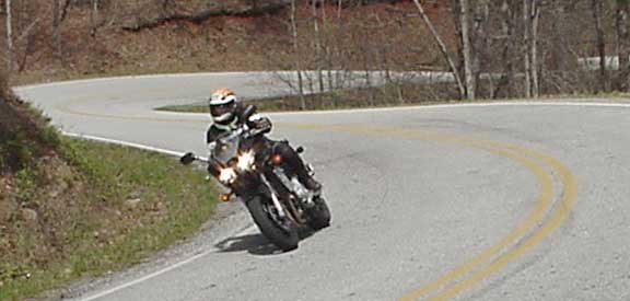
Warwoman Road

US178_
US178_2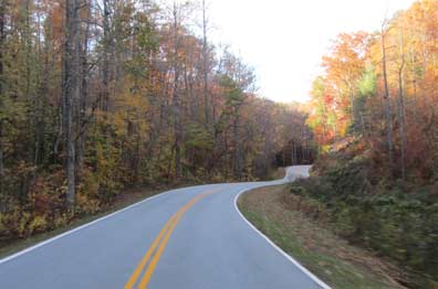
US178
US178
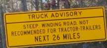
Truck Warning
TruckWarning
